
Smart cities are transforming the way we live, work, and interact with our environment. These cities use technology and data to improve the quality of life for citizens while also making the city more efficient and sustainable. In this blog post, we will discuss the benefits of smart cities and the role of urban planning …
Autor: lektor
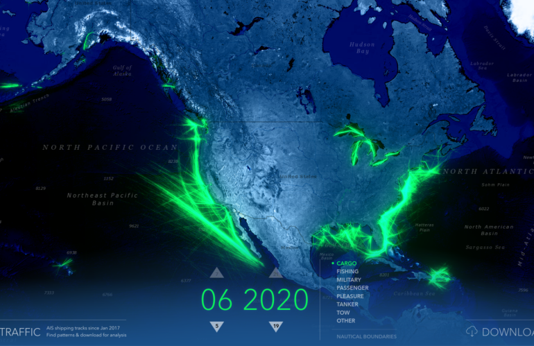
Imagery intelligence from a developer’s point of view
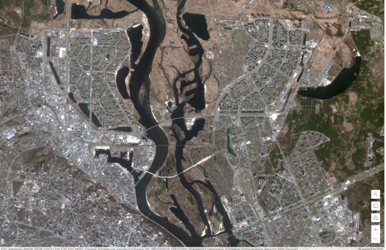
Satellite imagery analysis and visualization have become an important tool in a wide range of fields, including environmental science, urban planning, agriculture, and defense. As a developer, understanding the comprehensive story of satellite imagery analysis and visualization can help you create powerful tools and applications that harness the power of satellite imagery. Once you have …
China’s secret naval base in Cambodia
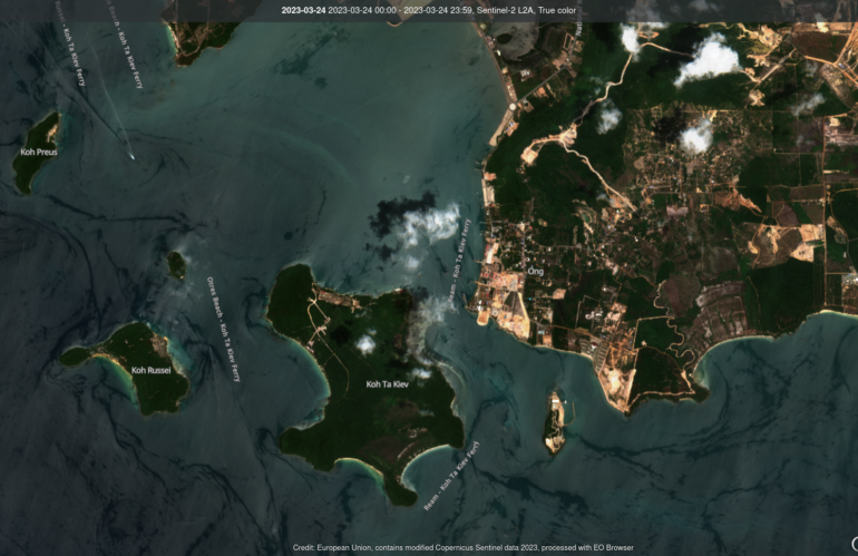
In recent years, tensions have been on the rise in the South China Sea, with China aggressively pursuing its territorial claims in the region. One recent development that has caught the attention of analysts is the discovery of a secret naval base in Ream, Cambodia. The base, which was detected through image intelligence, has raised …
The hidden capabilities beyond pixels
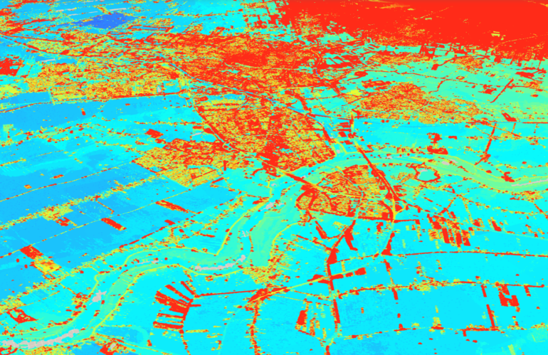
Photogrammetry and remote sensing are two important fields that deal with the acquisition and interpretation of data about the Earth’s surface using various remote sensing technologies. These technologies include satellites, aerial imagery, and LiDAR, among others. The use of these technologies has skyrocketed in recent years, and they have become essential tools for spatial data …
3D visualization for Digital Twins
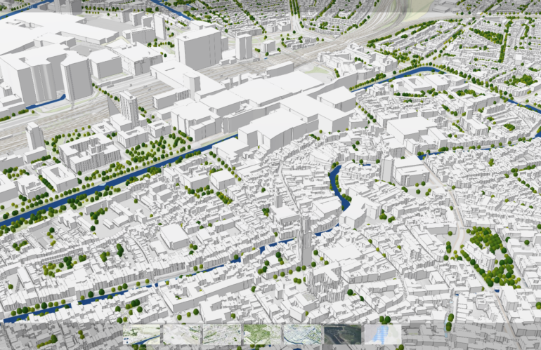
Digital twins are virtual replicas of physical objects, processes, or systems that are used to monitor, analyze, and optimize their real-world counterparts. These digital twins are becoming increasingly important in fields such as manufacturing, engineering, and urban planning, as they allow us to simulate and test different scenarios before implementing changes in the real world. …
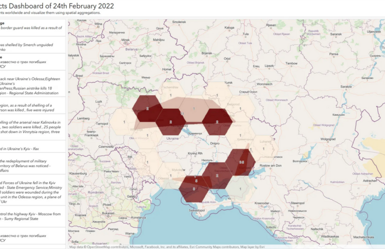
Mapping the armed conflicts events of 24th February 2022
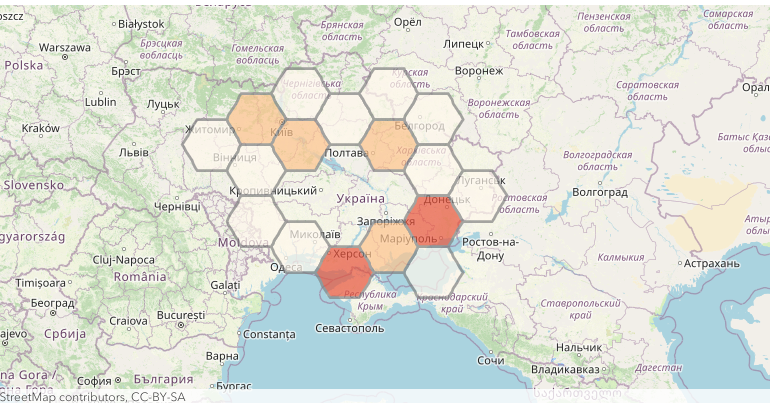
By mapping the armed conflict events of 24th February 2022, you can recognize the Russian invasion of Ukraine without being a military expert. For this Open Source Intelligence workflow, we can rely on ready-to-use mapping and location services being deployed as a platform-as-a-service offering. If you are a developer, or someone with Python scripting capabilities, …
Yet another armed conflict database
Armed conflict databases are collections of information about armed conflicts, including information about the parties involved, the duration of the conflict, and the location of the conflict. We can use these databases for a variety of purposes, including academic research, policy analysis, and conflict resolution. Armed conflict databases can be useful for identifying trends and …
Location intelligence and its sibling Geospatial Intelligence
Location intelligence is a type of data analysis and visualization that helps organizations make better business decisions by using geographic data and mapping tools. It involves the collection, integration, and analysis of geographic data from a variety of sources, such as satellite imagery, spatial databases, and location-based services. This data is then used to create …
Tell me something about spatial data science and the relation to GIS
Spatial data science is a field that combines the principles of data science with the analysis of spatial data and geographic information. It involves the use of statistical, mathematical, and computational techniques to understand and analyze data that is linked to a specific location on the earth’s surface. One of the key goals of spatial …
Using Sentinel-1 SAR data for Imagery Intelligence – Detection of vessels
Sentinel-1 is the first spacecraft in the European Space Agency’s Copernicus Program satellite system. This mission comprises two satellites, Sentinel-1A and Sentinel-1B, which circle in the same orbital plane. They have a C-band SAR (synthetic aperture radar) equipment that collects data in any weather condition, day or night. The satellites offer a maximum spatial resolution …