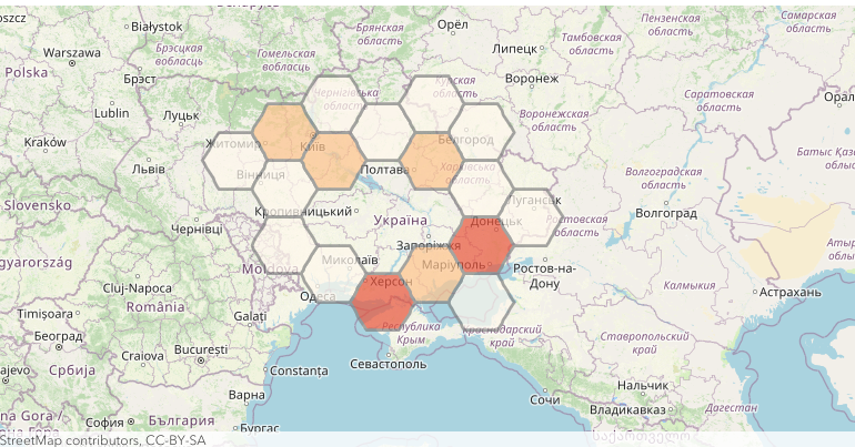
By mapping the armed conflict events of 24th February 2022, you can recognize the Russian invasion of Ukraine without being a military expert. For this Open Source Intelligence workflow, we can rely on ready-to-use mapping and location services being deployed as a platform-as-a-service offering.
If you are a developer, or someone with Python scripting capabilities, the following approach is an effective way of getting your hands dirty with geospatial intelligence.
The map widget offers common spatial capabilities for identifying spatial patterns of the armed conflict events. With the help of platform-as-a-service offerings, we mapped the armed conflict events of 24th February 2022 using a web map in minutes.
