
In the era of rapid urbanization, understanding and managing urban mobility has become a pressing concern. At the heart of this challenge lies the need for robust, scalable, and precise tools that can simulate and analyze urban traffic patterns. Enter the Geospatial Urban API, a ground-breaking technology that is set to revolutionize our approach to urban mobility.
The Future of Urban Mobility
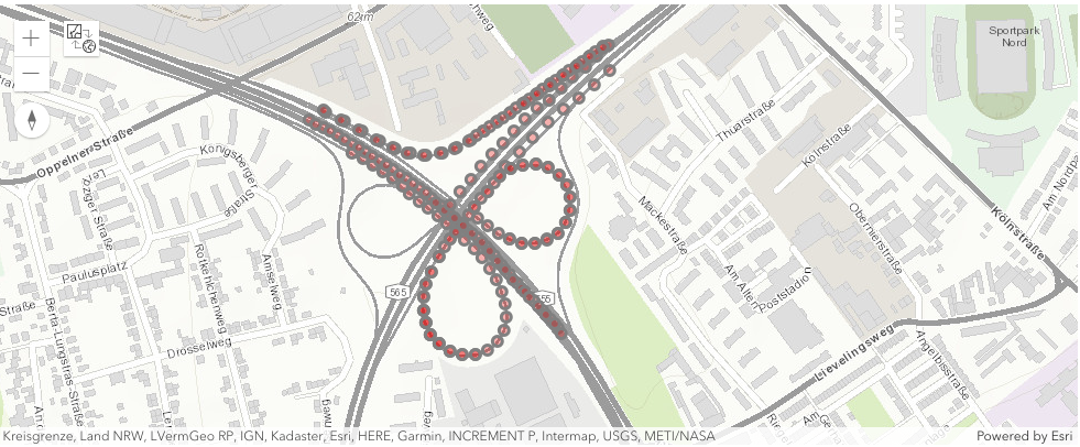
The Geospatial Urban API leverages simulated traffic grids of urban regions, representing aggregated simulated movements of pedestrians, bikes, and cars over a 24-hour period. These simulations provide a granular view of urban mobility, allowing us to visualize and understand the complex dynamics of urban traffic. Imagine being able to predict traffic congestion, optimize public transportation routes, or even design smarter cities. With the Geospatial Urban API, these are no longer mere possibilities, but realities within our grasp.
Harnessing the Power of the Geospatial Urban API
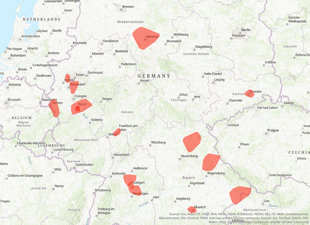
The Geospatial Urban API is not just about data; it is about accessibility. With the geourban Python module, users can easily access simulated agent positions within space and time. This means you can query and visualize the traffic grids of 15 urban regions in Germany, right at your fingertips. Whether you are a city planner looking to optimize public transportation, a tech company developing the next generation of autonomous vehicles, or a researcher studying urban mobility, the Geospatial Urban API provides the tools you need to make informed decisions.
Conclusion
The Geospatial Urban API represents a significant leap forward in our ability to understand and manage urban mobility. But this is just the beginning. We invite visionaries and technology buyers to join us in exploring the potential of this technology. Together, we can leverage the power of the Geospatial Urban API to simulate, analyze, test, and mitigate traffic scenarios, paving the way for a sustainable, efficient, and smart urban future. Are you ready to be part of this exciting journey? Try out the Geospatial Urban API today and take the first step towards transforming urban mobility.