Direct access to simulated spatially enabled traffic grids of urban regions.
The geospatial urban API solves a common challenge for urban digital twins – obtaining insights into mobility behavior of citizens using simulated traffic scenarios. Traffic planners use powerful tools in shaping urban mobility sustainable. But without having access to citizen movement profiles there is always a need for simulating, analyzing, testing and mitigating traffic scenarios.
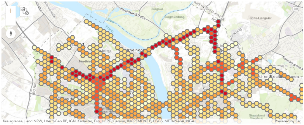
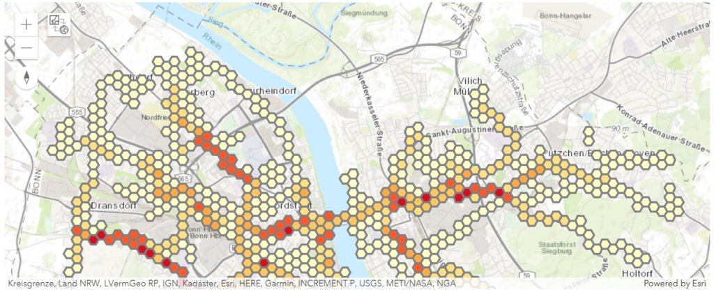
Developers get access to ready-to-use spatially enabled traffic grids. These traffic grids represent aggregated simulated movements of pedestrians, bikes and cars. Each grid has an accumulated variable like the number of agents, the average speed and the sum of carbon dioxide equivalent emissions (kg/km) of car vehicles. The traffic simulation calculates these variables for 24 hours and each generated grid has a temporal resolution of one hour.
/top
Returns the top most accumulated traffic grid cells for an urban region.
| name | type | description | option | sample |
| region | STRING | The simulations endpoint returns all available urban regions. You have to use the region code, e.g. DEA22 for the city of Bonn, Germany. | required | DEA22 |
| date | DATE | Represents the simulated date. The simulations endpoint list the available urban regions with their simulation dates. The date must be defined using ISO format, e.g. 2023-08-24. | required | 2023-08-24 |
| vehicle | STRING | Car, Bike and Pedestrian are possible vehicle types. | required | Car |
| grid | STRING | The values agent, speed and emissions are supported grid types. agent: The number of unique agents is calculated. speed: The speed average of every agent is calculated. emissions: The sum of carbon dioxide emissions of every agent is calculated. This makes only sense for vehicle being cars! | required | agent |
| limit | NUMBER | The maximum number of returned features. | optional | 10 |
| format | STRING | The values esri and geojson are supported output formats. | optional | geojson |
/aggregate
Returns a spatially enabled traffic grid representing aggregated simulated movements of pedestrians, bikes and cars.
| name | type | description | option | sample |
| region | STRING | The simulations endpoint returns all available urban regions. You have to use the region code, e.g. DEA22 for the city of Bonn, Germany. | required | DEA22 |
| vehicle | STRING | Car, Bike and Pedestrian are possible vehicle types. | required | Car |
| grid | STRING | The values agent, speed and emissions are supported grid types. agent: The number of unique agents is calculated. speed: The speed average of every agent is calculated. emissions: The sum of carbon dioxide emissions of every agent is calculated. This makes only sense for vehicle being cars! | required | agent |
| time | STRING | Represents the simulated start time. The simulations endpoint list the available urban regions with their simulation dates. The time must be defined using the simulation date and the time being on the hour, e.g. 2023-08-24T07:00:00. | required | 2023-08-24T07:00:00 |
| format | STRING | The values esri and geojson are supported output formats. | optional | geojson |
/query
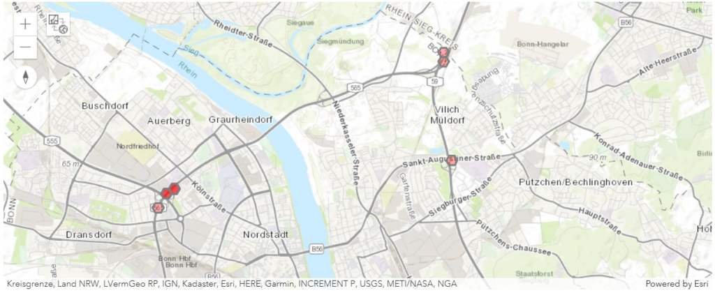
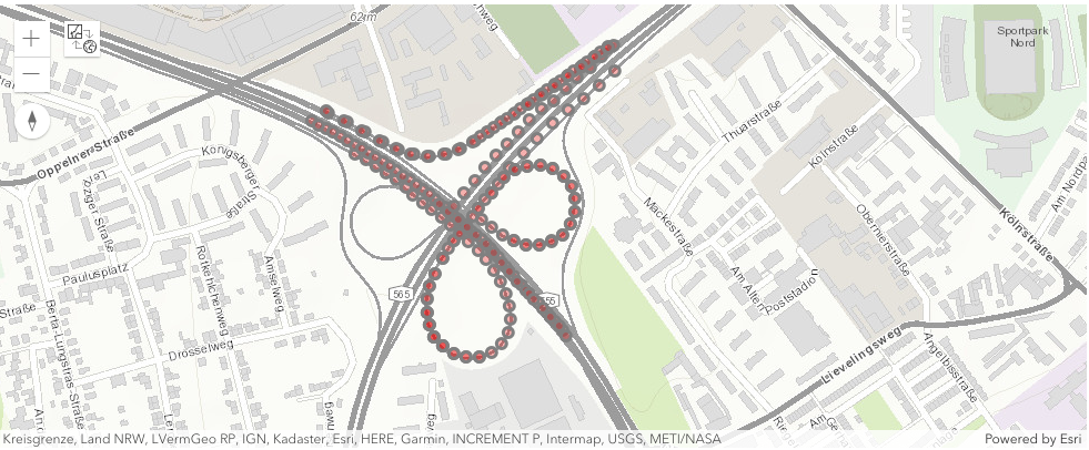
Queries the simulated agent positions in space and time. Returns all positions within a certain radius of a given location and within a certain time frame.
| name | type | description | option | sample |
| datetime | STRING | Represents the simulated date and time. The query endpoint returns the simulated agents locations for this specific time. The value must be defined using ISO format. | required | 2023-08-24T08:00:00 |
| vehicle | STRING | Car, Bike and Pedestrian are possible vehicle types. | required | Car |
| lat | NUMBER | The latitude coordinate of the location. | required | 50.746708 |
| lon | NUMBER | The longitude coordinate of the location. | required | 7.074405 |
| seconds | NUMBER | The duration of the time frame defined in seconds. The maximum duration is 120 seconds. | optional | 60 |
| meters | NUMBER | The planar distance/radius in meters defining the area of interest. The maximum distance is 1000 meters. | optional | 500 |
| format | STRING | The values esri and geojson are supported output formats. | optional | geojson |
/simulations
Returns all the available simulations using the urban region and the simulation date.
| region | name | date |
| DEA2D | Aachen, Stadtregion | 2023-12-10 |
| … | … | … |
| DEA22 | Bonn, Kreisfreie Stadt | 2023-08-24 |
| … | … | … |
| DE111 | Stuttgart, Landeshauptstadt | 2023-11-25 |
References:
[1] geourban API @RapidAPI
Direct access to simulated spatially enabled traffic grids of urban regions.