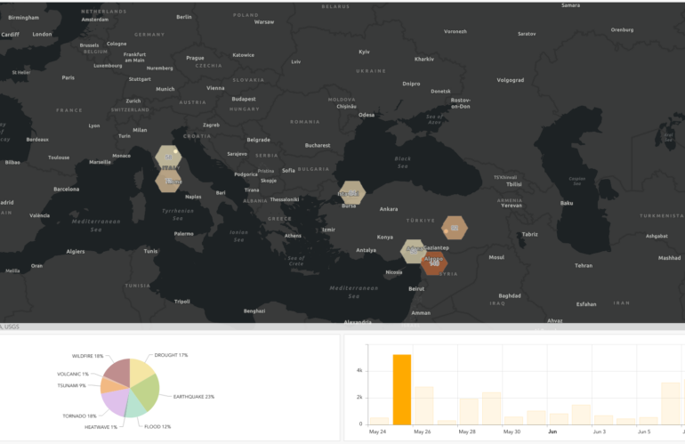
We use broadcasted news to find hotspots for natural disasters. Looking for patterns in the locations mentioned in relation to these disasters is a common geospatial intelligence workflow. This doesn’t just include the place where the event happened, but also other related locations. News about a broken dam near Kherson and mentioning Moscow creates an interesting, often semantic link.
ArcGIS Online offers ready-to-use web and instant apps. We published our collected geospatial features and got insights into natural disasters. Our geospatial intelligence portal implementation using Python offers publishing, inserting and querying of features.
Combining mapping and geospatial intelligence services supports common intelligence workflows. The time-enabled web map offers insights into the flooding of Kherson, Ukraine.