In the rapidly evolving landscape of the digital era, where smart devices, Internet of Things (IoT), and mobile solutions reign supreme, spatial data has emerged as the lifeblood of enterprises. Today, businesses thrive or falter based on their ability to gather, process, and analyze large volumes of spatial data with speed and precision. This paradigm …
Jahr: 2023
Design carbon-effective spatial data science
Carbon-effective means reducing the carbon footprint for an activity or process. Carbon emissions cause global warming and harm to the environment, so we need to focus on reducing them to fight climate change. As geospatial engineers, we have a unique opportunity to make a positive impact on the environment through our work. The design, development, …
Track and reduce your carbon footprint

Spatial data science plays a vital role, revolutionizing various industries and driving progress like never before. However, this technological growth has come at a cost: A rise in carbon dioxide (CO2) emissions. The emissions from cloud data center and their energy consumption contribute to climate change and pose a serious threat to our environment. Therefore, …
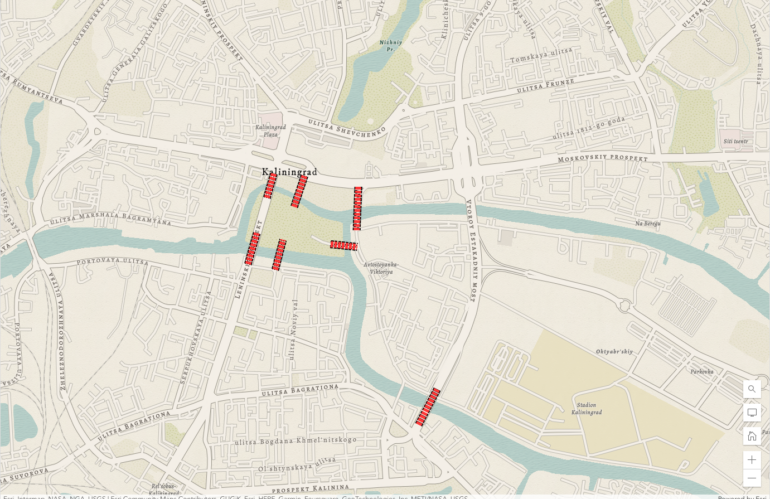
Detecting the flooding of Kherson using broadcasted news related to natural disasters

We use broadcasted news to find hotspots for natural disasters. Looking for patterns in the locations mentioned in relation to these disasters is a common geospatial intelligence workflow. This doesn’t just include the place where the event happened, but also other related locations. News about a broken dam near Kherson and mentioning Moscow creates an …
Mapping the broadcasted news related to natural disasters
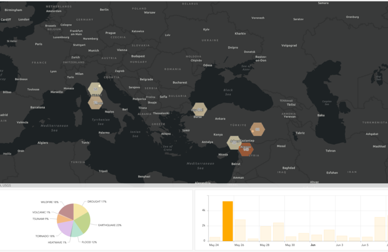
We experienced heavy shifts in temperature and weather patterns. Climate change is related to natural shifts and much more beneficial human activities. The broadcasted news articles related to climate change and the rise of natural disasters describe various cases. A massive knowledge graph saves the extracted semantic entities of the broadcasted news worldwide. Understanding the …
Earth day 2023 visualize the predicted vulnerabilities
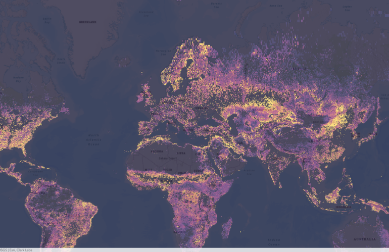
Clark Labs, a research and development company based in Worcester, Massachusetts, is at the forefront of using geospatial intelligence to predict vulnerability change. Through their cutting-edge research, they are harnessing the power of Earth observation data, specifically the maps provided by the European Space Agency (ESA), to create predictive models that can forecast changes in …
The legacy of knowledge graphs
A knowledge graph is a powerful capability for organizing and representing complex information in a structured and interconnected way. The concept of knowledge graphs dates back several decades, with former work on semantic networks and ontology modeling in the fields of artificial intelligence and knowledge representation. The Königsberg bridge problem was a puzzle that had …
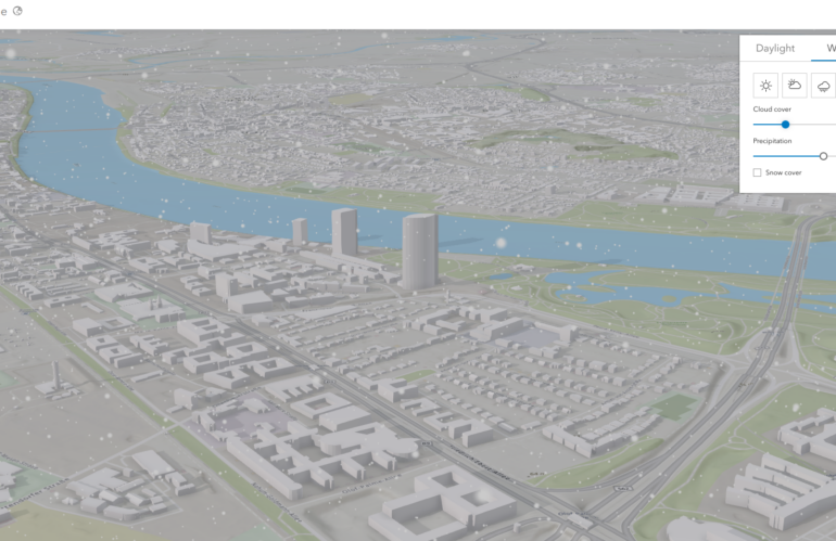
Smart Cities and Urban Planning

Smart cities are transforming the way we live, work, and interact with our environment. These cities use technology and data to improve the quality of life for citizens while also making the city more efficient and sustainable. In this blog post, we will discuss the benefits of smart cities and the role of urban planning …
Imagery intelligence from a developer’s point of view
Satellite imagery analysis and visualization have become an important tool in a wide range of fields, including environmental science, urban planning, agriculture, and defense. As a developer, understanding the comprehensive story of satellite imagery analysis and visualization can help you create powerful tools and applications that harness the power of satellite imagery. Once you have …
China’s secret naval base in Cambodia
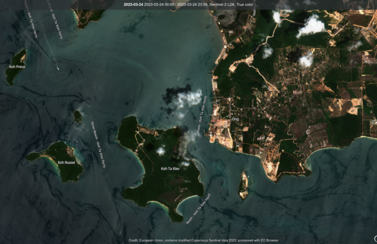
In recent years, tensions have been on the rise in the South China Sea, with China aggressively pursuing its territorial claims in the region. One recent development that has caught the attention of analysts is the discovery of a secret naval base in Ream, Cambodia. The base, which was detected through image intelligence, has raised …