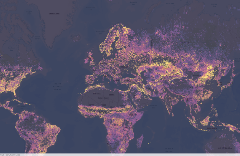
Clark Labs, a research and development company based in Worcester, Massachusetts, is at the forefront of using geospatial intelligence to predict vulnerability change. Through their cutting-edge research, they are harnessing the power of Earth observation data, specifically the maps provided by the European Space Agency (ESA), to create predictive models that can forecast changes in …
Schlagwort: Imagery
Imagery intelligence from a developer’s point of view
Satellite imagery analysis and visualization have become an important tool in a wide range of fields, including environmental science, urban planning, agriculture, and defense. As a developer, understanding the comprehensive story of satellite imagery analysis and visualization can help you create powerful tools and applications that harness the power of satellite imagery. Once you have …