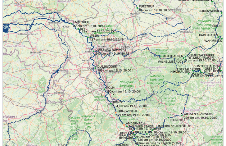
The Pegel Viewer is a simple desktop map application visualizing the current water levels. The underlying web map service displays the current water levels with an update interval of 15 minutes. A water level is the perpendicular distance usually in centimeters of a point of the water level above the level zero point. The water level tells nothing about the local water depth or about the height reference to the surrounding terrain. You can determine the height of the water level above normal altitude zero by adding the water level at the level with the corresponding value of the level zero point.
The zero point of a level is the absolute distance in meters above sea level in relation to the official elevation system DHHN92. You can determine the value of the level zero point by using the operator of the level. The level zero point is usually below the lowest water level measured over a long time period.
The desktop map application visualizes daily raw values of various hydrological parameters (e.g. water level) of inland and coastal gauges on federal waterways up to a maximum of 30 days retrospectively.
All current water levels are unchecked and provided with no guarantee of their accuracy by the competent waterways and shipping authorities or directorates.